The Mapping of Africa and Scotland

Home » Wiki » The Mapping of Africa and Scotland
No Comments
Wikis > The Mapping of Africa and Scotland

Introduction

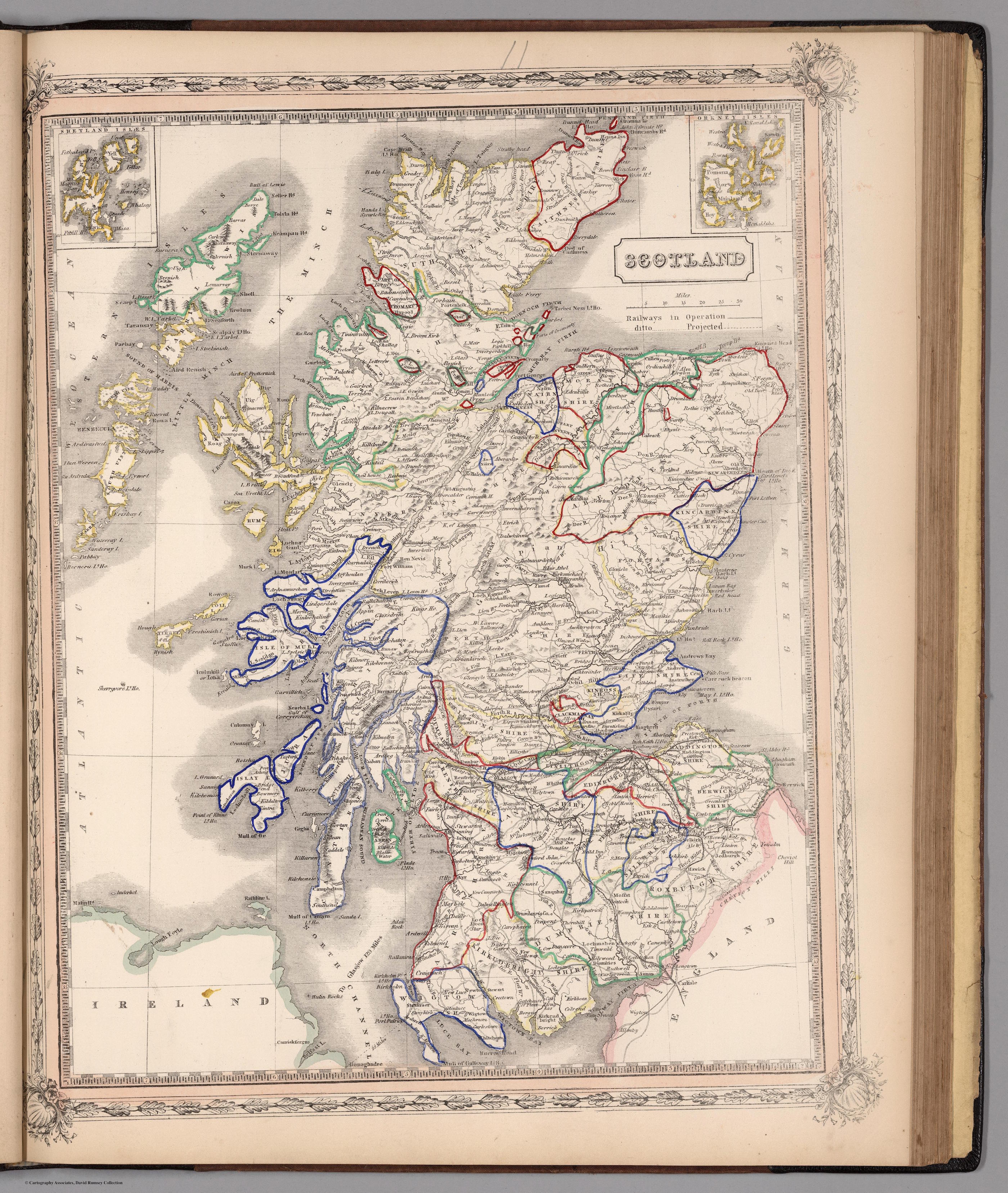
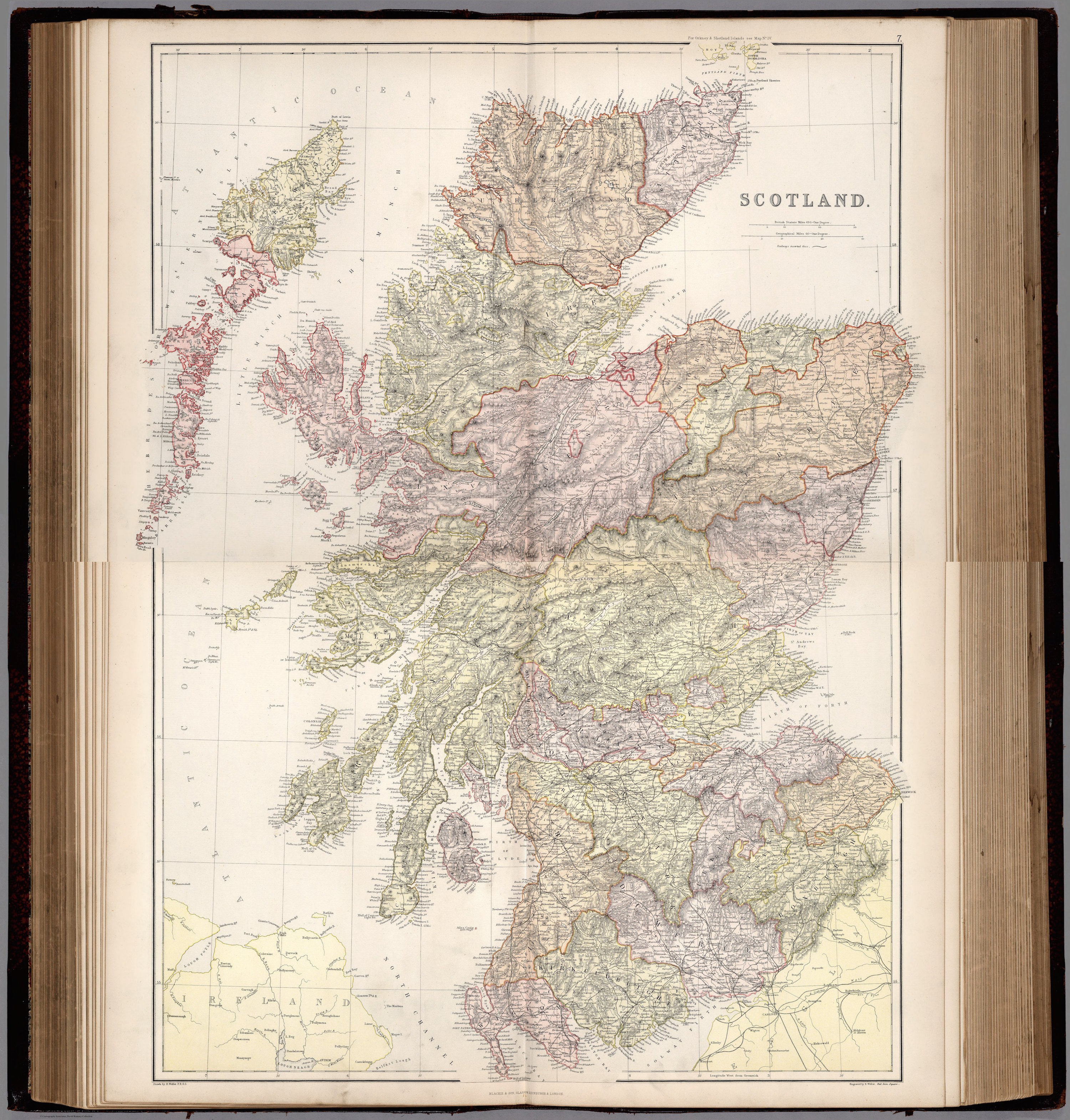
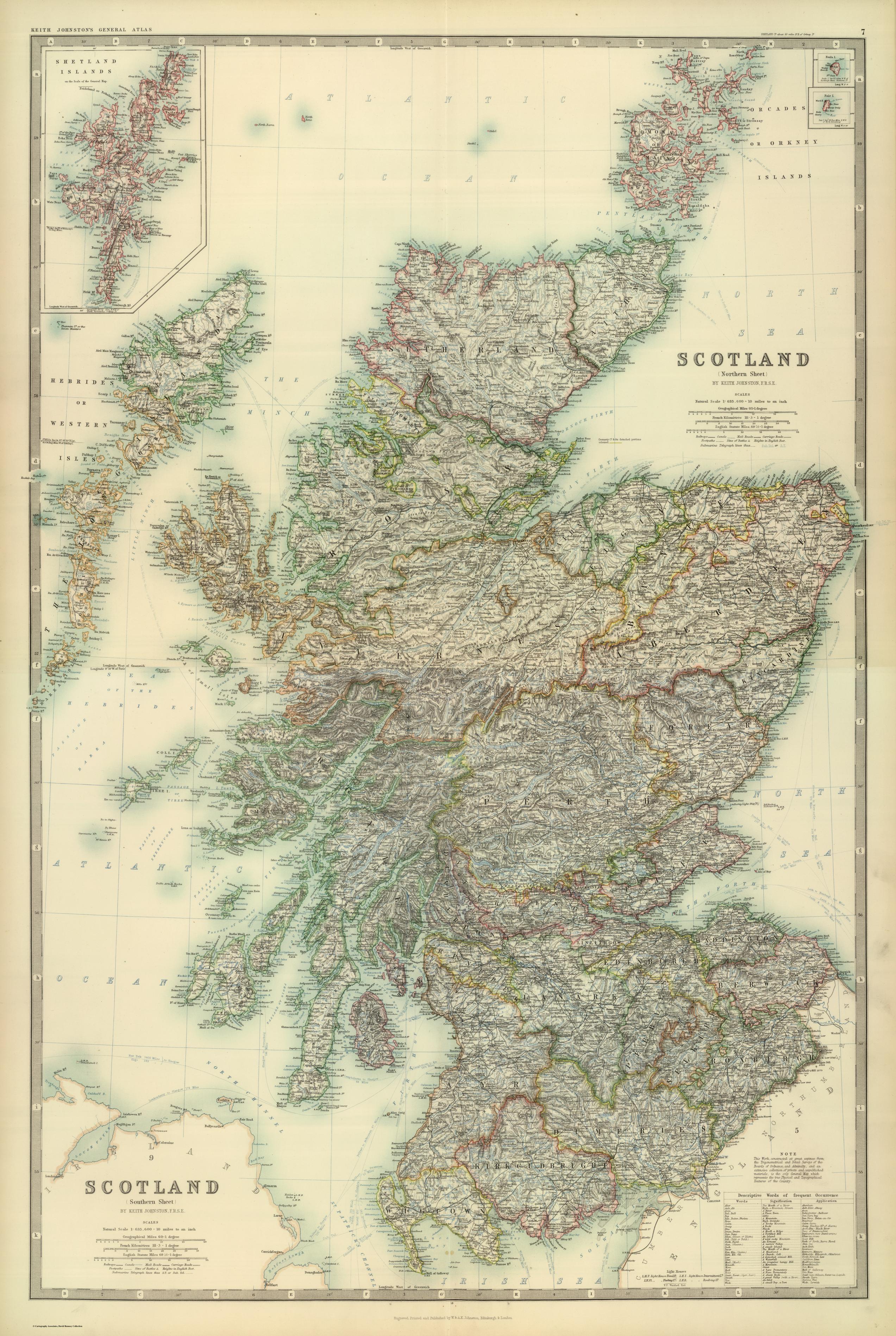
The earliest detailed maps of Scotland were those by Timothy Pont (c.1564-c.1614), forming the first atlas of Scotland and being part of Joan Bleau’s (c. 1599-1673) world atlas Theatrum orbis terrarum, sive Atlas novus. The maps of Scotland in his atlas can be found here, Pont’s maps can be found here. Pont was the first to detail the mountains, place names and geographical features.

Chinese africa map

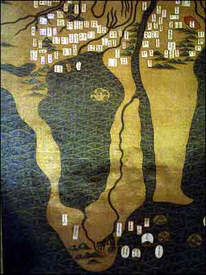
Chinese map of Africa 1389

The earliest representation of Africa was by Chinese traders who had been visiting the continent since the 1st century or even earlier, taking animals back to China and in some cases staying and marrying local people. By the 1389 the Chinese created a map made of silk, covering more than 17 square metres in size. It is thought to be a copy of a map sculpted into rock 20 or 30 years earlier.

An unknown Portuguese cartographer created the earliest European map of Africa in 1502 who drew the Cantino planisphere It forms part of a larger atlas of the world, as the Portuguese knew it, after their great voyages of exploration at the end of the 15th century to the Americas, Africa and India. It is considered to be the earliest extant nautical chart where places (in Africa and parts of Brazil and India) are depicted according to their astronomically observed latitudes.

Cantino_planisphere_(1502)

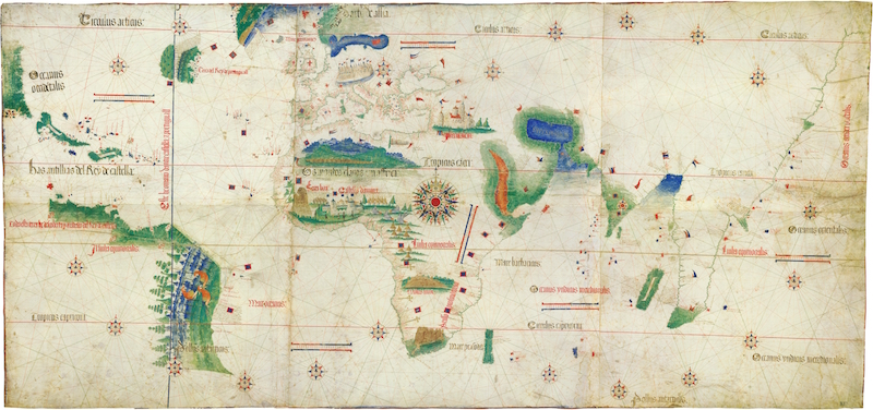
Cantino planisphere with Africa in the centre

Detail of its construction and use can be found here.

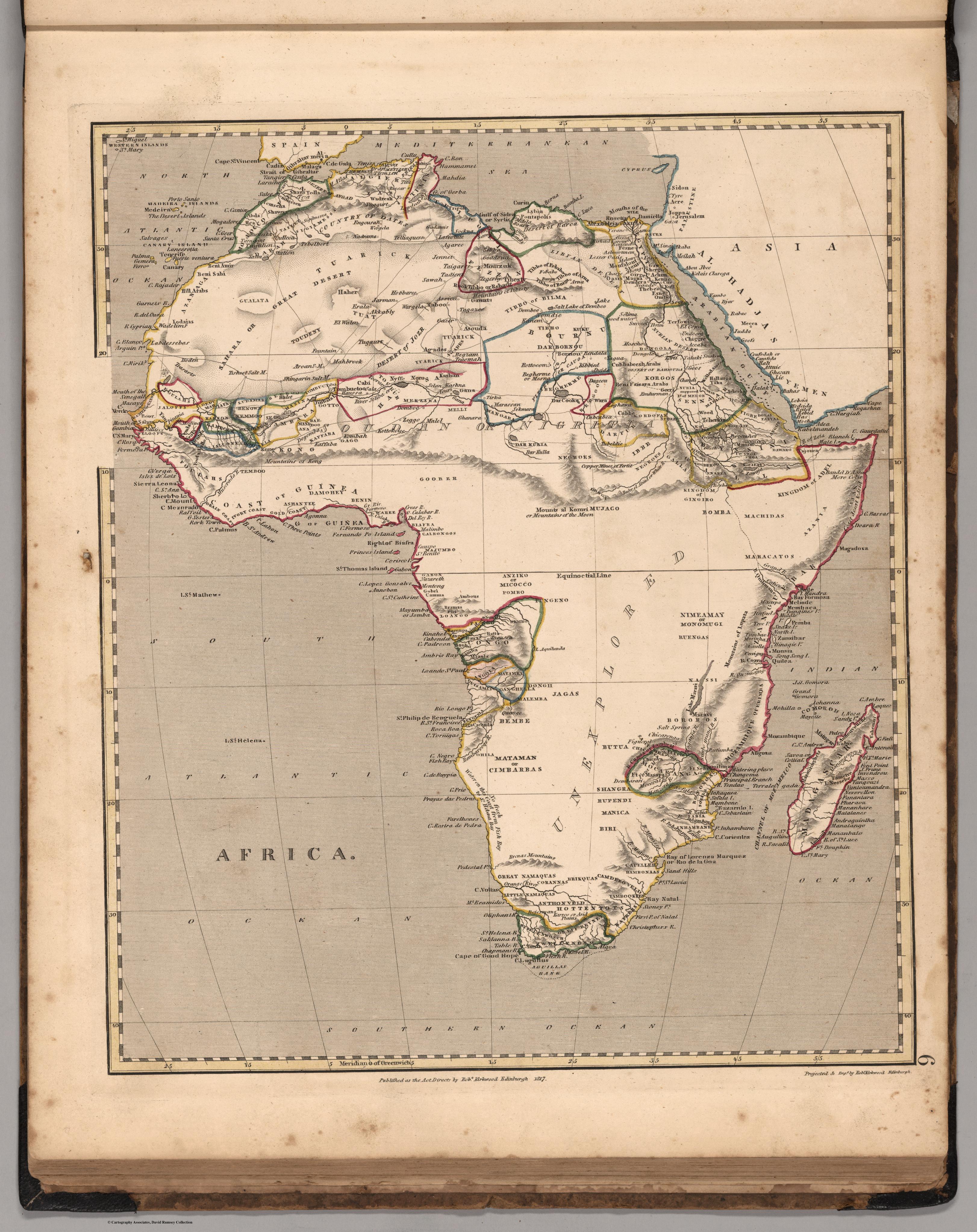
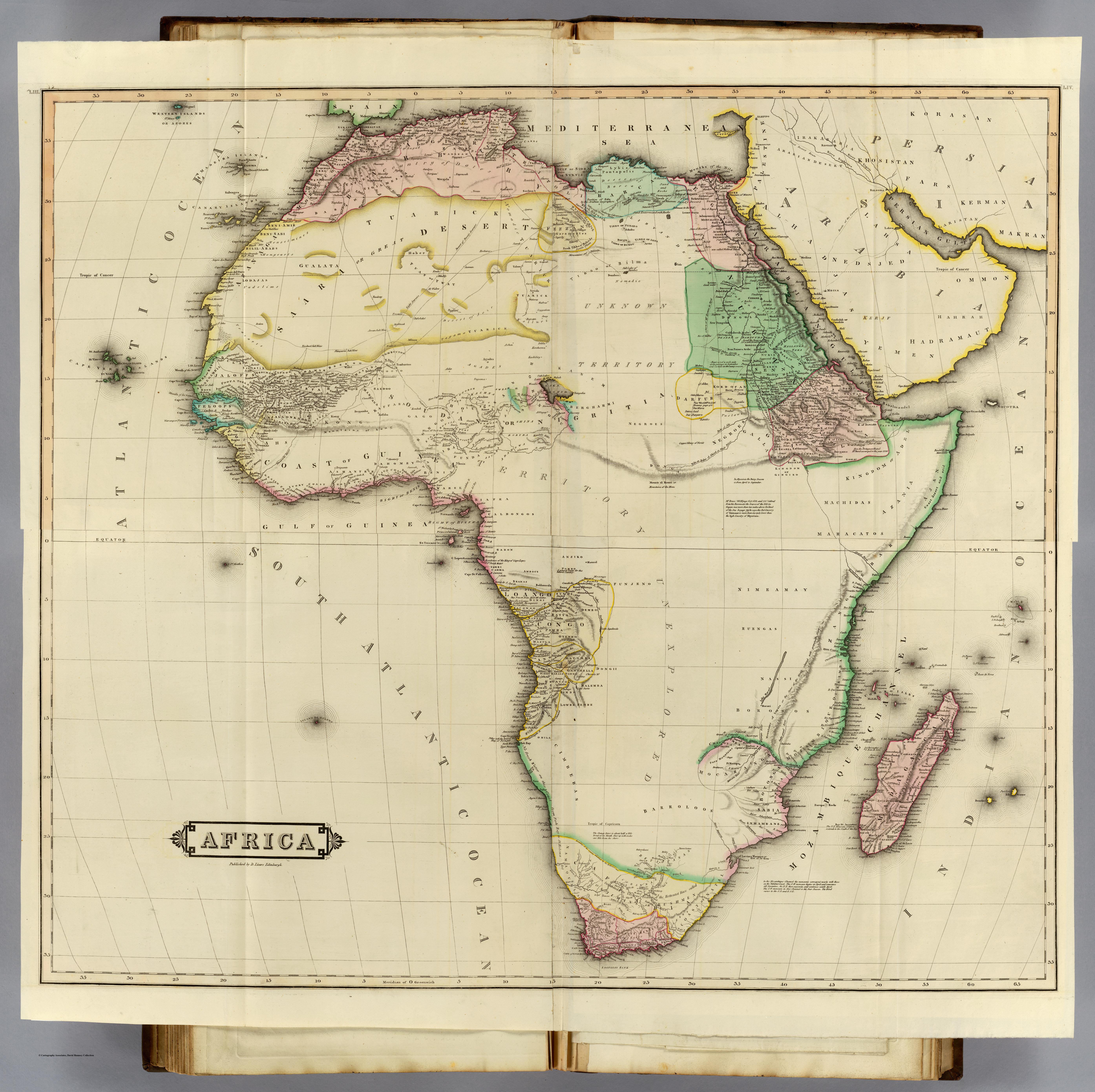
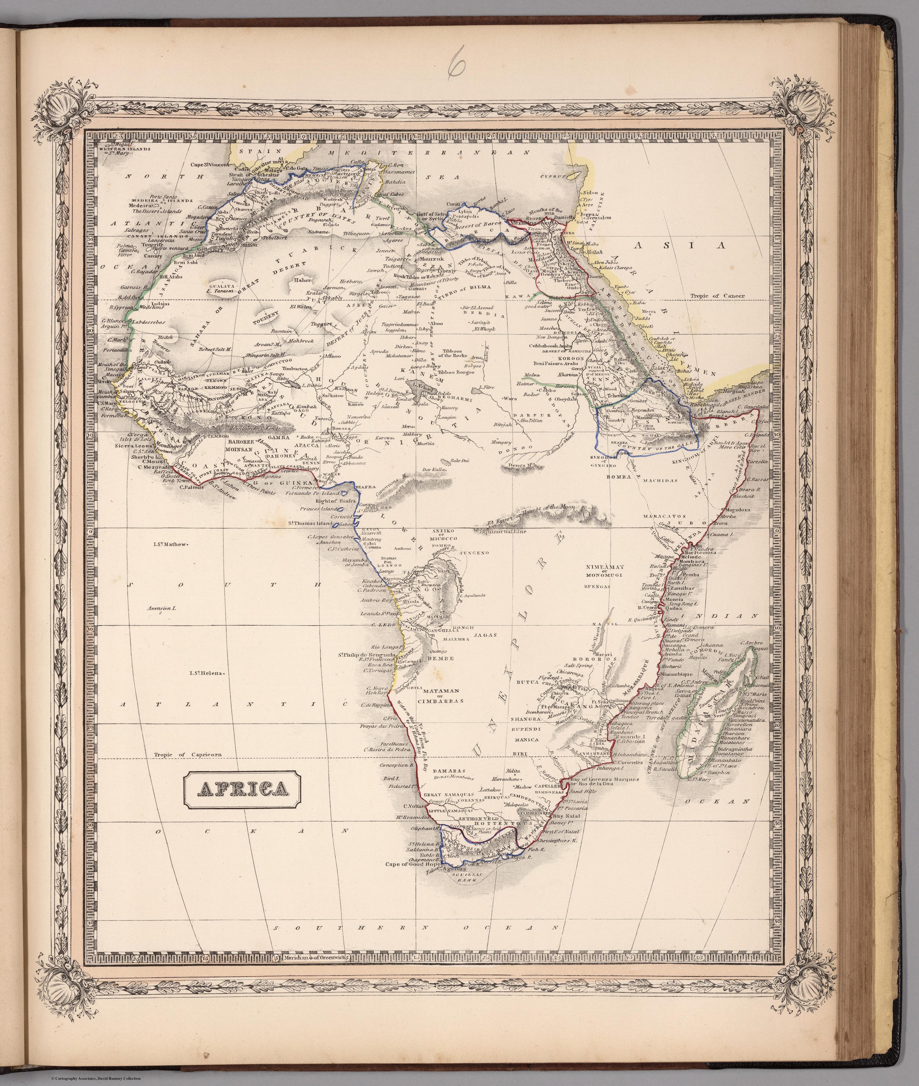
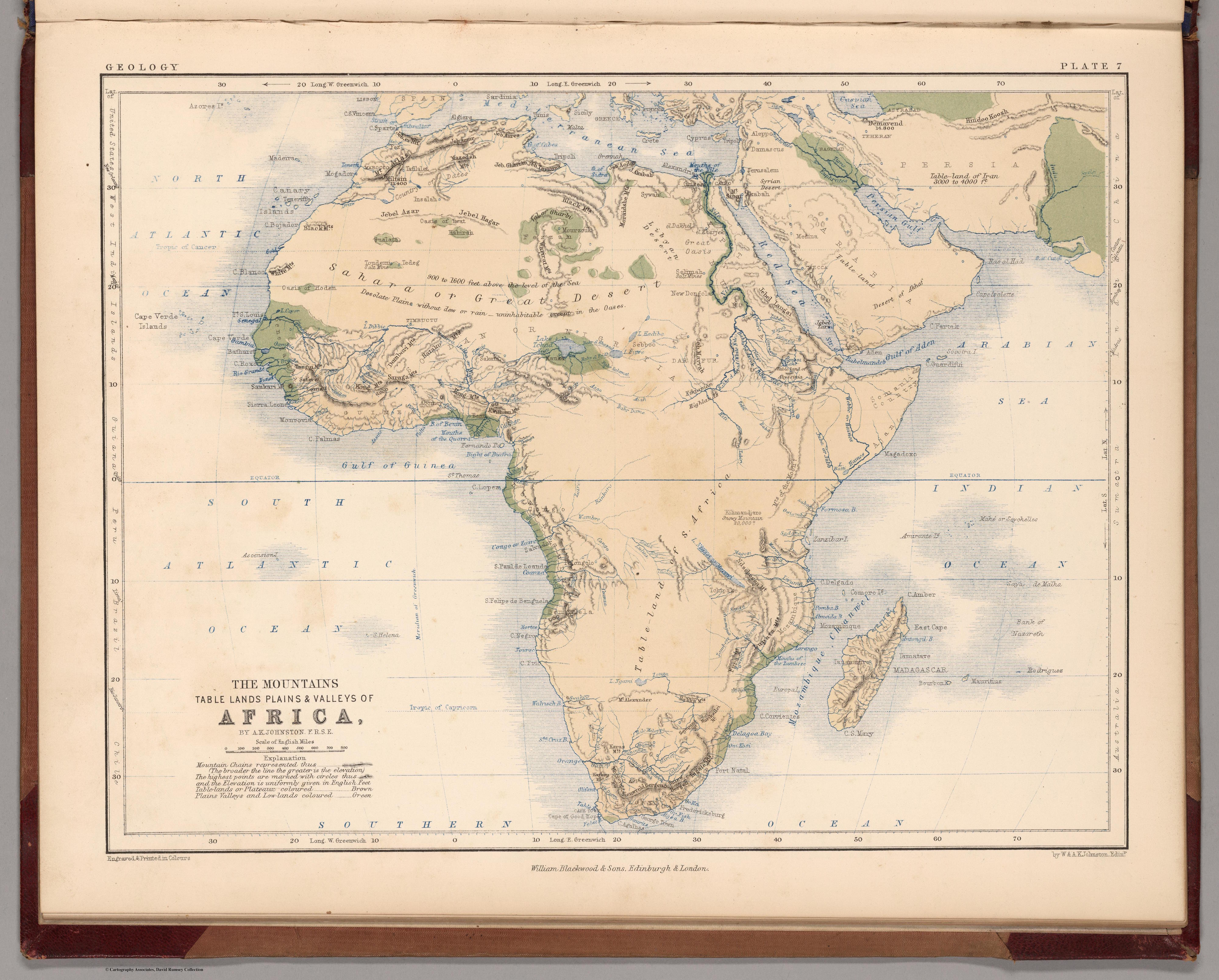
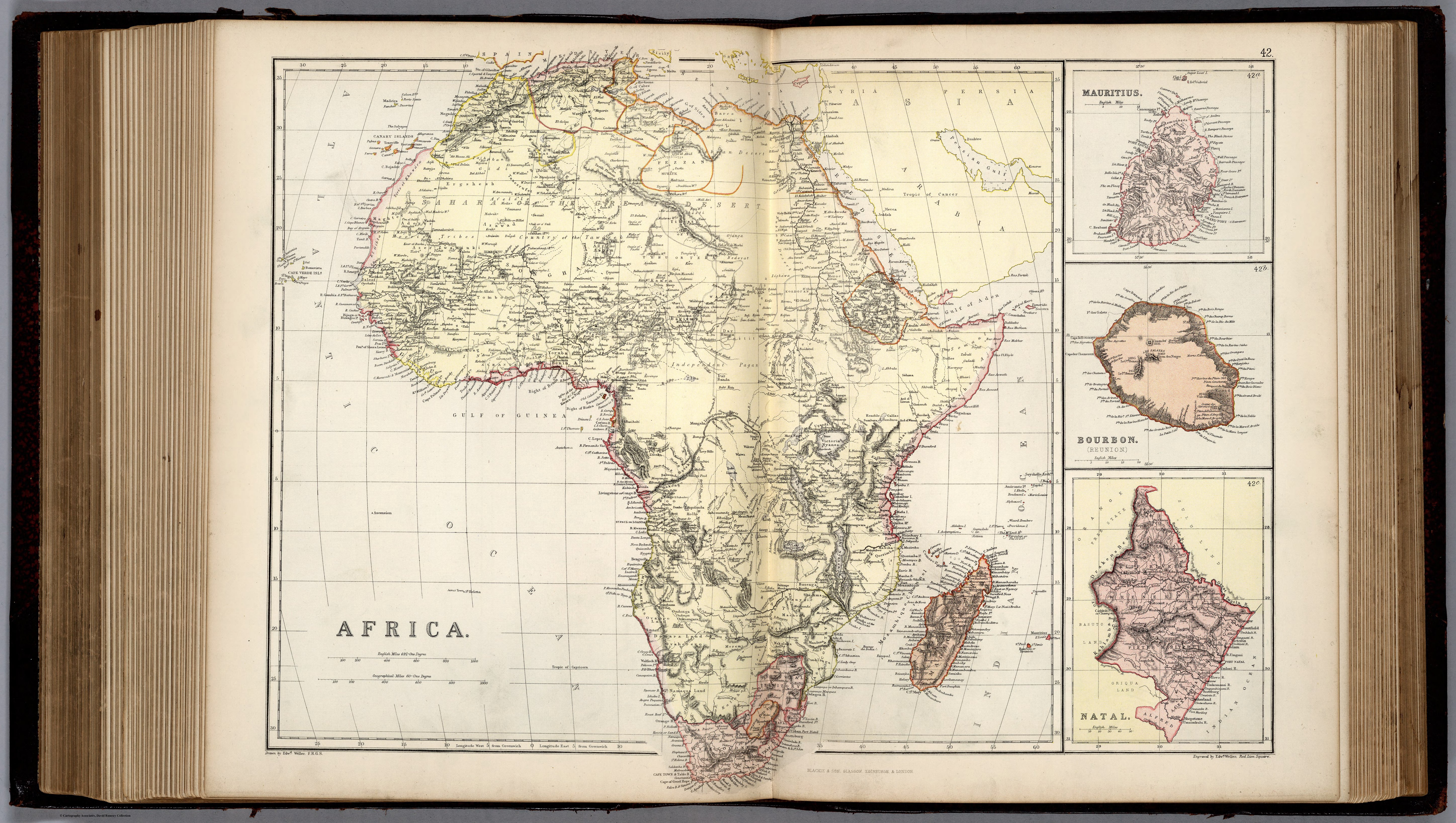
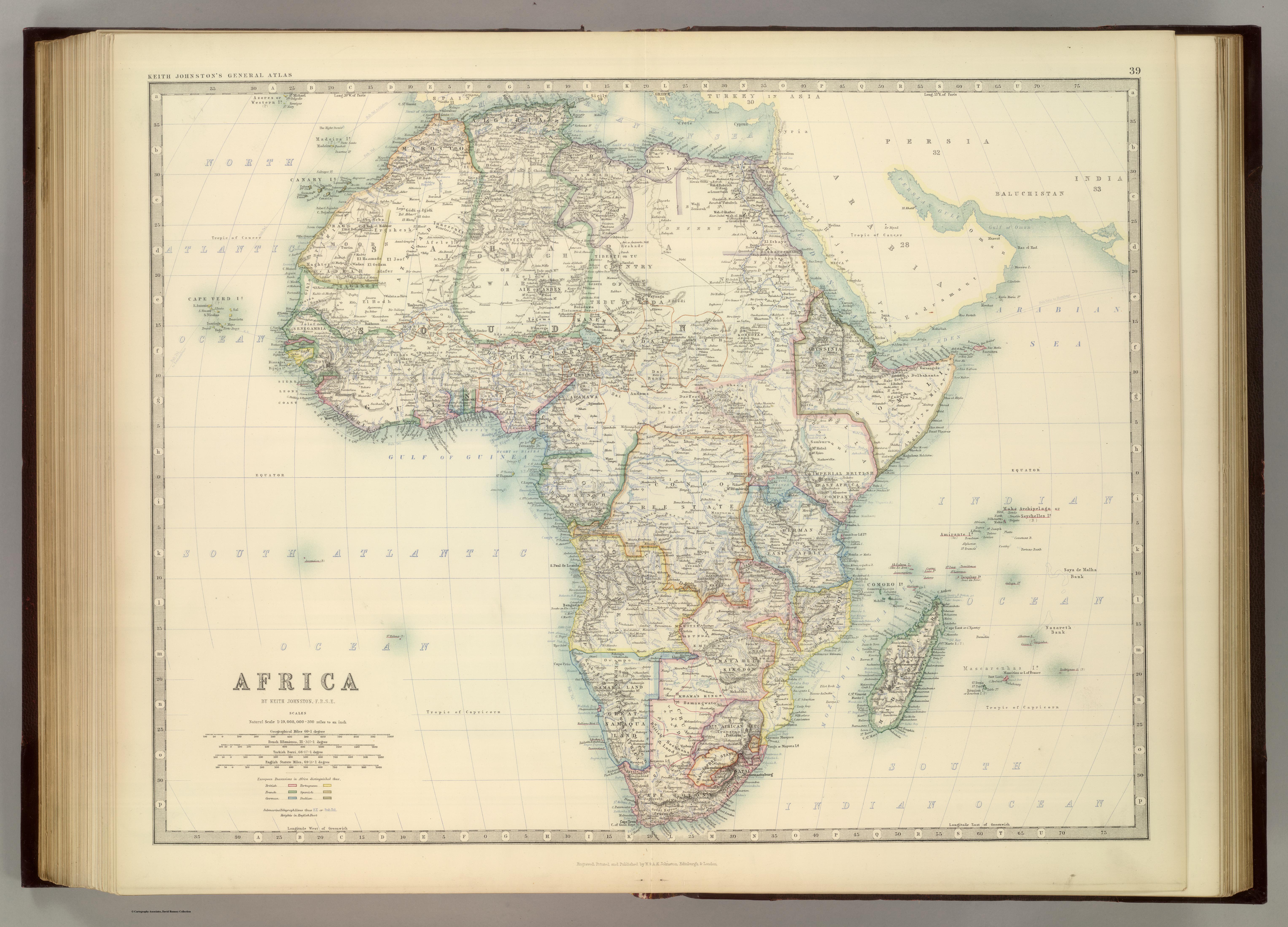
From the eighteenth century onwards a large portion of the African coast had been mapped, but areas in the centre of the continent were often labelled “unexplored” waiting for explorers, missionaries, slavers and traders to fill in the gaps.

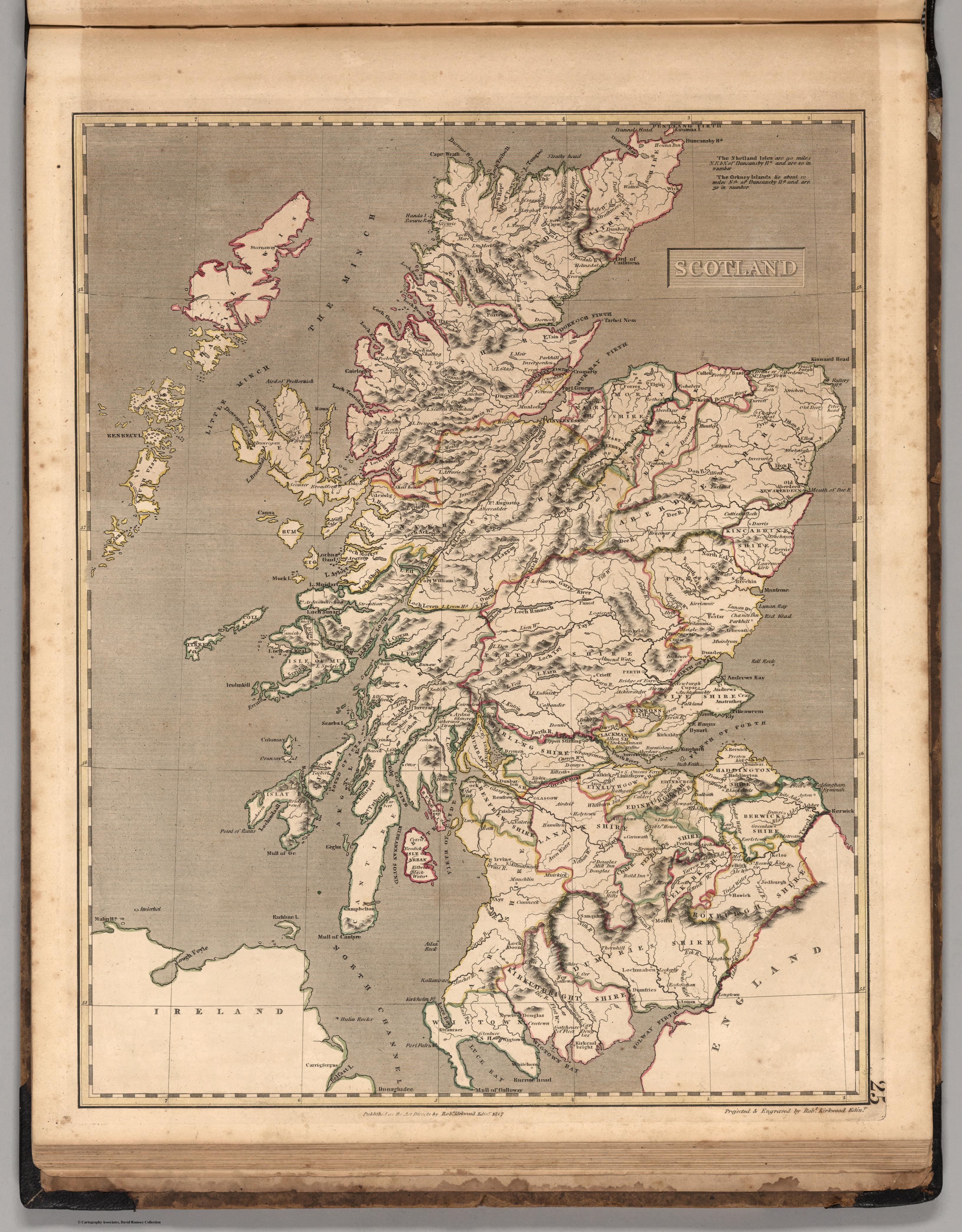
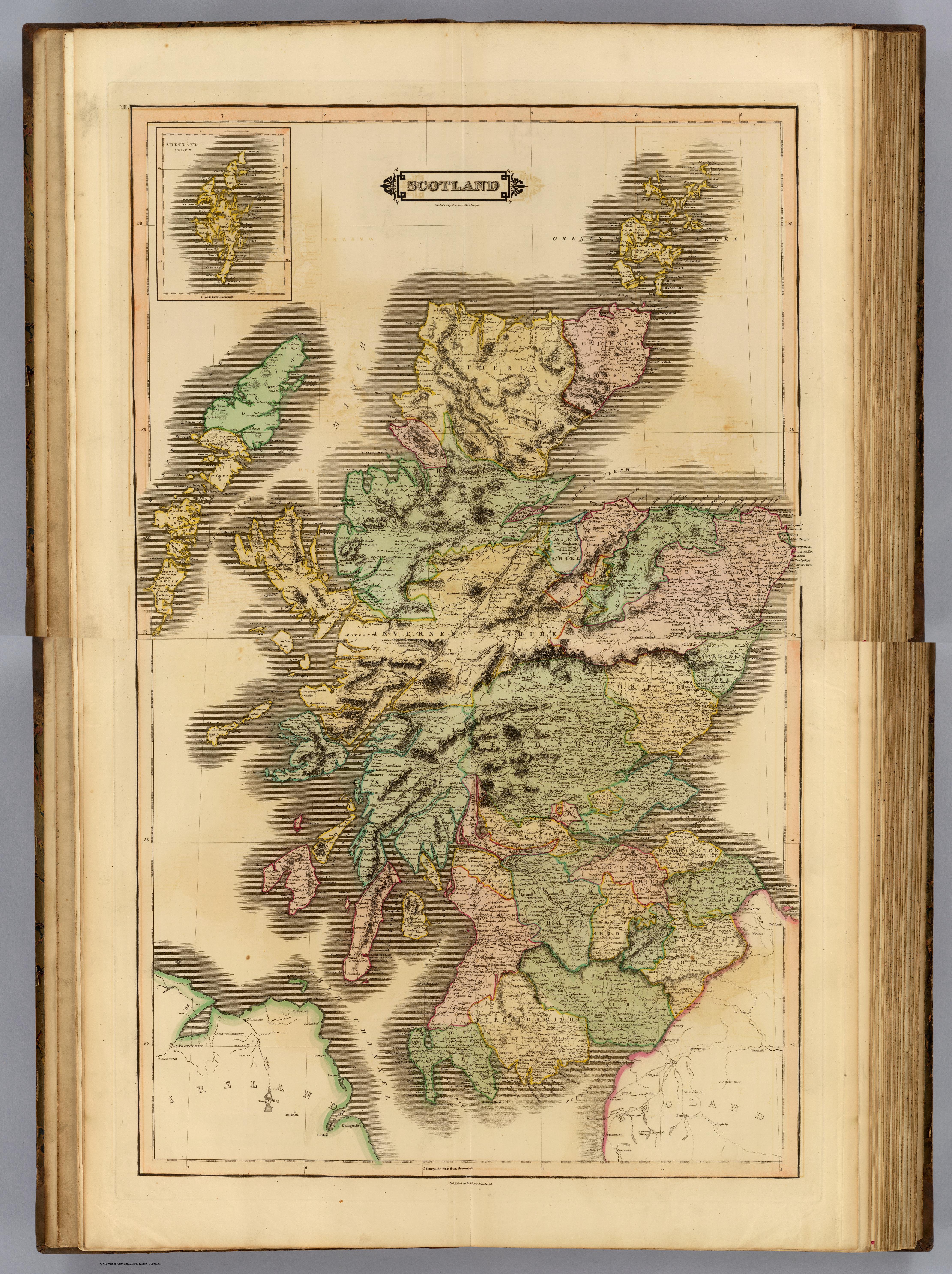
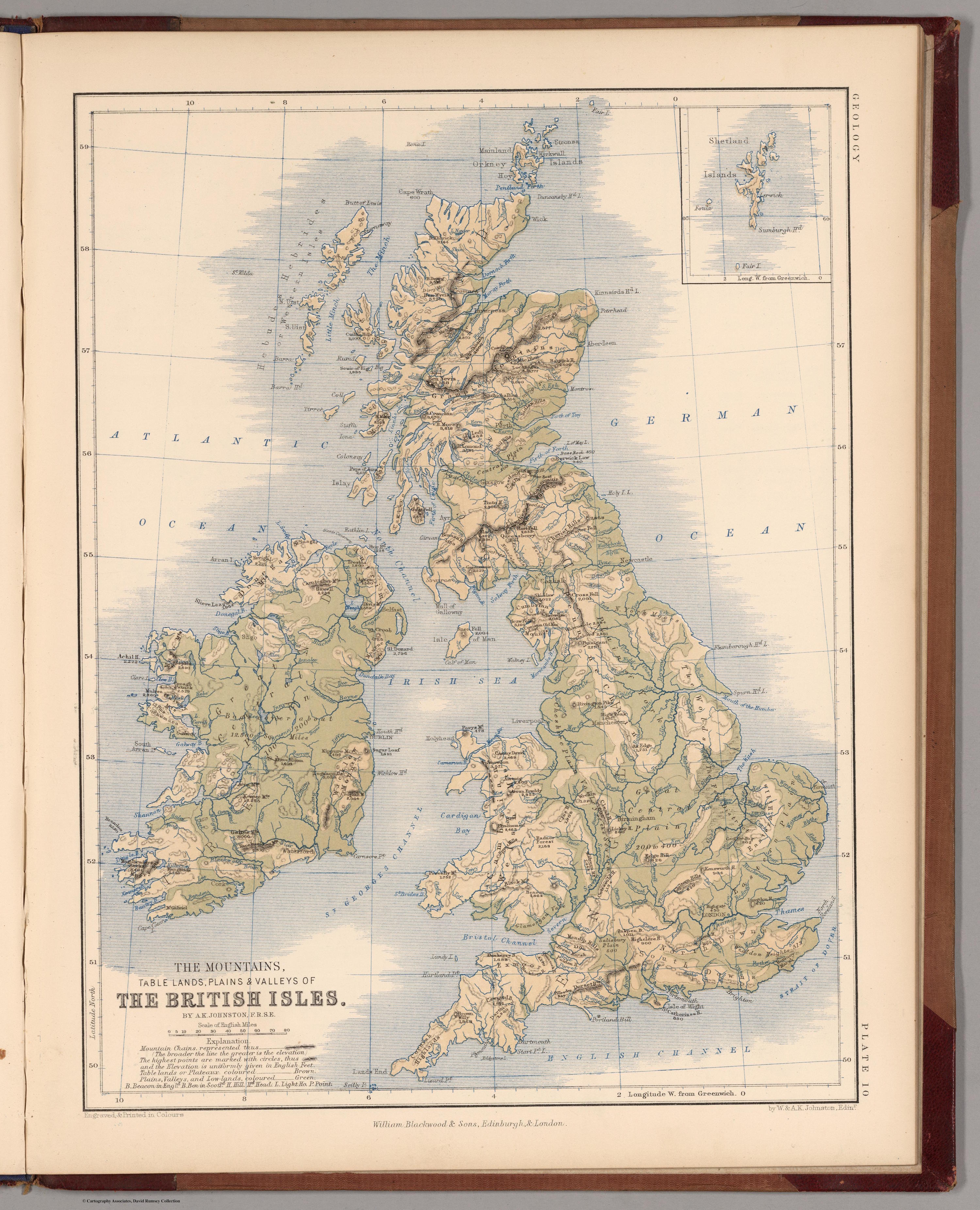
Comparing maps of Scotland and Africa from 1817 through to 1925 shows how much had been learned both of the African continent and of Scotland in terms of detail recorded. The examples chosen are of those published or created in Scotland, usually from Glasgow or Edinburgh. Many were created as part of a world atlas; the maps of Scotland are also from the same atlases for comparison. Many other maps were drawn to accompany many of the travel writings by explorers and missionaries, such as the Map of the Lake Region of Eastern Africa and of the Upper Nile Basin by Alexander Keith Johnston who was both an explorer and cartographer.

Kirkwood Africa 1817

1817

(Edinburgh: Published by Robert Kirkwood) Kirkwood’s General Atlas ... Constructed from the best Authorities extant. Published as the Act directs by Robert Kirkwood, Engraver, Edinburgh; John Smith & Son, Booksellers, Glasgow; & William Faden, London. 1817.

It contained 45 maps and was 33cm x 42cm in size. Full atlas can be viewed here.

Kirkwood Scot 1817

Lizars Africa 1831

1831

(Edinburgh: Published by John Hamilton) The Edinburgh Geographical and Historical Atlas, Comprehending a Sketch of the History of Geography ... and History of Each Continent, Ktate, and kingdom, Delineated. And a Tabular View of the Principal Mountain Chains in the World. Engraved on Sixty-nine Copperplates, and Compiled from Materials Drawn from the Newest and Most Authentic Sources. Edinburgh: Published by John Hamilton, 15, South St. Andrew Street, successor to Daniel Lizars; Whittaker, Treacher, & Co., Ave-Maria Lane, London; and W. Curry, Jun. & Co., Dublin. (1831?)

Considered to be one of the finest maps of the period, the atlas was very accurate in this first edition. It had 59 maps and was 49 x 35 cm in size.

Full atlas can be viewed here.

Lizars Scot 1831

Lothian Africa 1848

1848

(Glasgow: Published by James Macleod) The People’s Atlas, Shewing The Relative Extent And Divisions, The Boundaries, and Other Geographical Details of the Various Empires, States, and Quarters of the World, Agreeably to the Best Authorities, and in Accordance with a Comparative View of the Heights of Hills and Lengths of Rivers, Revised by J. Lothian. Glasgow: James Macleod, 20 Argyle Street, and Francis Orr & Sons, William Tait, Edinburgh; Simpkin, Marshall, & Co. London; A. Heywood, Manchester; And J. Cumming, Dublin. MDCCCXLVIII [1848].

It contained 46 maps, and was 42 x 34 cm in size.

Full atlas can be viewed here

Lothian Scot 1848

Johnston Africa 1852

1852

(Edinburgh: Published by William Blackwood) Atlas Of Physical Geography, Illustrating, In A Series Of Original Designs, The Elementary Facts Of Geology, Hydrology, Meteorology, And Natural History. By Alex. Keith Johnston, F.R.S.E. F.R.G.S. F.G.S ... Second Edition. William Blackwood And Sons, Edinburgh And London. MDCCCLII [1852].

It had 18 maps and was 36 x 28 cm in size (this was smaller than its first edition)

Alexander Keith Johnston was an African explorer see Scots in Africa. His African map was called: Mountains, Table Lands, Plains & Valleys of Africa ....

Full atlas can be viewed here

Johnston Scot 1852

Blackie Africa 1882

1882

(Glasgow: Blackie & Son) The Comprehensive Atlas & Geography Of The World: Comprising An Extensive Series Of Maps, A Description, Physical And Political, Of All The Countries Of The Earth; A Pronouncing Vocabulary Of Geographical Names, And A Copious Index Of Geographical Positions ... Compiled And Engraved From The Most Authentic Sources, Under The Supervision Of W.G. Blackie Ph.D., F.S.A. Scot. ... B. & S. Lucem Libris Disseminamus. London: Blackie & Son, 49 & 50 Old Bailey, E.C.; Glasgow, Edinburgh, And Dublin. 1882. (on verso) Glasgow: W.G. Blackie And Co., Printers, Villafield.

Edward Weller engraved the colour lithographic maps for the cartographers John Bartholomew & Son of Edinburgh. Ten colour lithographic plates illustrate the races of mankind with extensive text. It had 67 maps and was 40 x 33 cm in size.

Full atlas can be viewed here

Blackie Scot 1882

Johnston Africa 1893

1893

(Edinburgh: W. & A.K. Johnston) The Royal Atlas Of Modern Geography Exhibiting, In A Series Of Entirely Original And Authentic Maps, The Present Condition Of Geographical Discovery And Research In The Several Countries, Empires, And States Of The World By The Late Alexander Keith Johnston ... With Additions And Corrections To The Present Date By T.B. Johnston ... With A Special Index To Each Map. A New Edition. W.& A.K. Johnston, Edinburgh And London, MDCCCXCIII.

It contained 54 maps, and was 52 x 35cm in size.

See link to Alexander Keith Johnston

Full atlas can be viewed here

Johnston Scot 1893